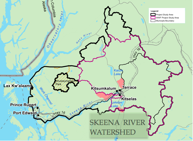
 The study area for the Climate Change Adaptation Planning Project (CCAP) and the Skeena River Watershed Conservation Project (SRWCP) contained within it, are depicted in the map above. The research area encompasses the ecologically, culturally, and economically significant North West Skeena River Watershed, including Tree Farm License 1 (TFL-1), Forest License Area 16835 (FLA-a6835), and their Non-renewable Forest and Range AAC on the coast. Also included are future Kitselas and Kitsumkalum Non-Renewable Forest and Range AAC and the connecting forests and watersheds that compromise about 20 000 km².
The Cities of Terrace and Prince Rupert are the focus of sociological research for municipal communities. In addition, the First Nations community of Lax Kw ‘alaams (formerly Port Simpson) and a second community to be confirmed will make up the other half of the sociological research.
The Skeena River is one of the world’s longest un-dammed rivers with a rich cultural heritage. The Tsimshian First Nations have lived here for thousands of years, supported by an environment that boasts some of the most productive salmon habitats and forest resources in BC.
The watershed holds great potential for social and economic development, but human use must also respect and value the ecosystem services and functions that are necessary for the longterm health and sustainability of nature, culture, and life in the Skeena.
To learn more about the potential impacts of climate change in the Skeena region, click here.
